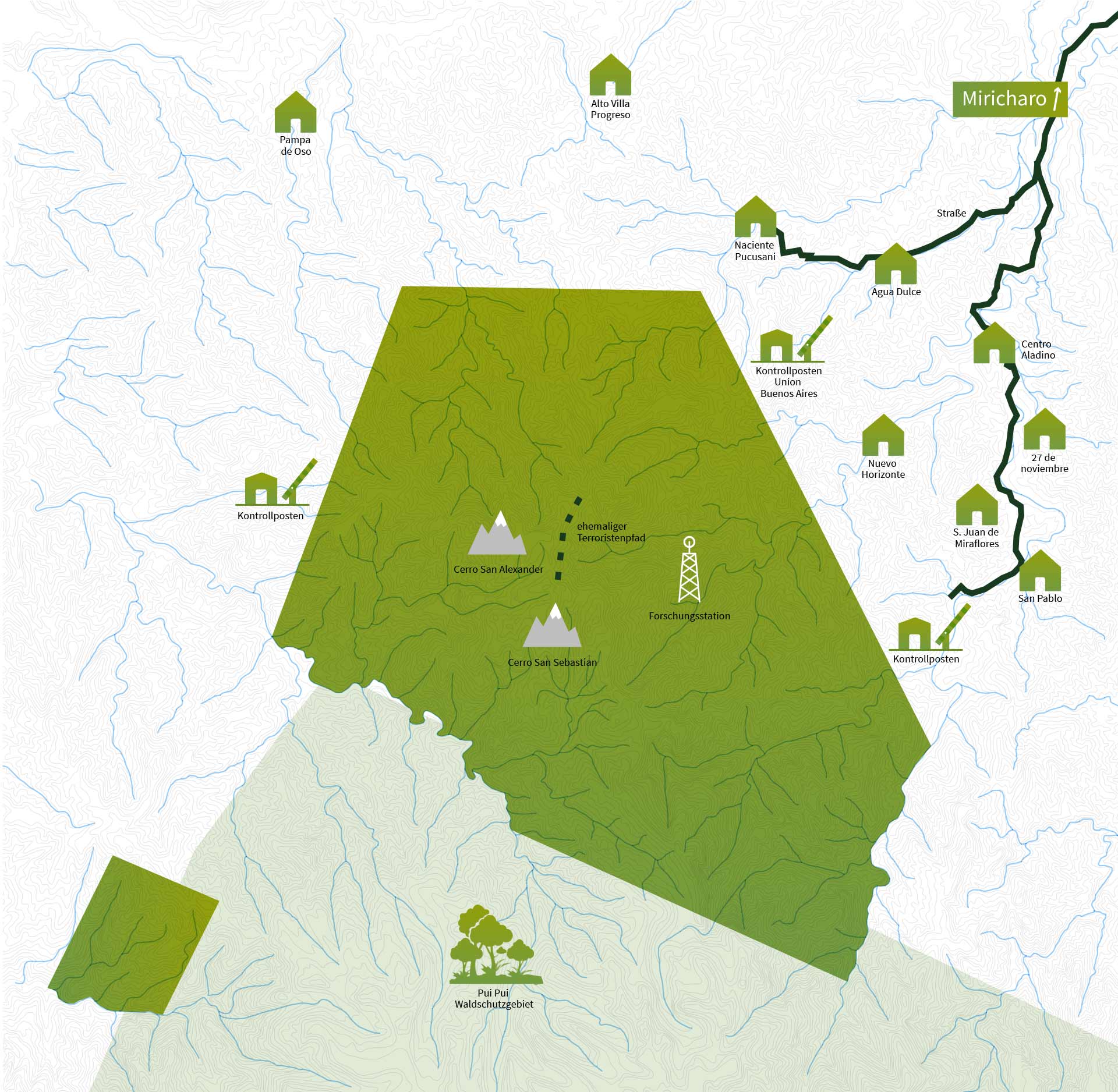
About ten villages lie to the north and east of the Mein Rainforest Conservation Area. Small farmers from the Andes live here surrounded by the rainforest. We support them in the fight against poverty and empower them to conserve and sustainably use the forests and rivers they live on.
We have installed checkpoints at three strategically sensible points to guarantee the protection of the forest.
A small research station is to be built in the center of Mein Regenwald. From here, students and scientists explore this unique ecosystem.
Mein Regenwald has survived to this day because there are few roads. However, the closer they are to the forest, the greater the threat to the rainforest.
During the bloody terror war that raged in Peru between 1980 and 2000, the area where Mein Regenwald is located today was a haven for terrorists. Here they hid, planned their attacks, and moved to Pichanaqui and other cities.
In the middle of the Mein Rainforest area are two mountains, Cerro San Alexander at 3000 meters and Cerro San Sebastian at 3500. They reach above the tree line and ensure the impressive biological diversity in the reserve.
Pui Pui is a state sanctuary bordering Mein Regenwald to the south. Pui Pui and Mein Regenwald together form a natural area through which the particularly species-rich forests on the eastern slope of the Andes are sustainably protected.